
Wheaton Neighbor Records by Block
A block search works best when every source has a narrow purpose. The parcel map defines location. The assessor supplies date-labeled tax fields. Recorder plats and easements explain how lots fit together. Election tools identify districts and polling details, not a public list of people. Historical directories can reconstruct the block in a chosen year. Public civic pages offer contact routes without exposing private membership.
| Source | What It Shows About a Block | Access |
|---|---|---|
| DuPage Parcel Viewer | Touching parcels, roads, subdivisions, geometry | Free map plus help PDF |
| DuPage Property Lookup | PIN, situs, tax-listed owner or billing name, class | Free, one parcel at a time |
| Recorder plats and easements | Lot formation, common access, legal ties | Online index from 1961; office fallback |
| Election district search | Precinct, polling place, district, sample ballot | Official address and district tabs |
| Historic directories and maps | Past address listings and block layout | Wheaton Public Library |
Tax-listed owners are not the same as current occupants. A billing address may belong to a trustee, estate, company, or owner who receives mail elsewhere. A directory entry is tied to its edition date. Even parcels that share a boundary may not be homes. Rail lines, alleys, parks, water land, utilities, or condominium common areas can interrupt the apparent row of Wheaton neighbors.
Map Wheaton Neighbors Parcel First
The DuPage County Parcel Viewer and its official instructions support PIN, address, and subdivision searches along with point, polygon, and buffer tools. A buffer is a set distance drawn around a selected point or shape. Define the distance before collecting parcels. “Neighbor” can mean a common lot line, the same block face, one street segment, or a set radius, and each rule produces a different answer.
- Search the known address and save its PIN, map layer, and capture date.
- Select parcels sharing a boundary, or set a small documented buffer for the chosen block definition.
- Check corners, alleys, shared drives, rights-of-way, common areas, and nonresidential shapes.
- Open only the needed parcel profiles in Property Lookup and retain the situs, PIN, tax year, and relationship label.
- Use a Recorder plat or easement when the geometry or shared access needs proof.
Use the same capture date for the subject and nearby parcels. If dates differ, label the result as a mixed-date snapshot. The map defines land relationships, not social ones, and an owner field does not establish who is home now. For the longer chain along an entire named road, use the Wheaton street directory workflow.
Read Wheaton Plats and Easements
A subdivision plat can explain why lots line up, where a public way ends, or why two parcels share access. Search the DuPage Recorder by subdivision, street, PIN, document type, or date. Keep the recorded document number and legal description with the map finding. An easement may connect several lots but does not name everyone who lives nearby.
When a current parcel seems too large or too small for an old block, inspect split and combine flags. A present address may cover part of an earlier tract. Conversely, an older legal description can span several modern parcels. This is where a parcel-based Wheaton neighbor search beats a simple address list: it can show that the land framework changed while the street name stayed the same.
Note: A subdivision name, shared easement, or common tax district describes land or administration, not membership in a social group.
Wheaton Neighbor District Checks
The DuPage Election Division lookup has address and district routes. The address form asks for house number, street name, separate direction and suffix, and city. The district route can return polling, precinct, committeeperson, or sample-ballot information for many district types. Those tools help explain which public boundaries serve a block.
They are not a way to publish the registered voters around an address. Illinois Election Code rules limit copying, transmission, personal or commercial use, advertising, solicitation, marketing, intimidation, and other misuse of registration data. If an address fails, remove the directional or street type from the street-name box and place it in the separate controls. A format failure does not mean that no record exists.
| Official route | Useful block question | Keep separate |
|---|---|---|
| Address search | Which precinct or polling route serves this address? | Do not create a people roster |
| District search | Which city, school, park, library, or fire district applies? | District borders are not city borders |
| Assessor districts | Which taxing bodies attach to the parcel? | Tax service does not prove social proximity |
Wheaton Neighborhood Contact Routes
No current official, complete directory of Wheaton residential associations was found. That gap matters. The 1999 Comprehensive Plan documents the Union Avenue Neighborhood and says residents formed the Union Avenue Neighborhood Association in response to a church-expansion issue. It is a dated civic-history lead, not proof that the group is active or that every nearby household belongs.
City Civic Contacts
Boards and Commissions provides public volunteer and commission routes without exposing private lists.
Union Avenue Lead
The 1999 Comprehensive Plan preserves the historical association reference and its context.
Downtown Wheaton
The Downtown Wheaton Association is a business and community organization at 206 N Main Street, not a resident association.
For a public contact, prefer the City, library, museum, historic commission, or an organization’s own official page. Do not copy private names, phone numbers, or emails from a member directory. That approach preserves a real community path while respecting Wheaton neighbors who never chose to appear in a public roster.
Downtown Wheaton Is Different
The Downtown Wheaton Association is a 501(c)(6) business and community organization, not a list of residents. Its public page is useful for downtown events, board material, and contact context. It should never be treated as evidence that a person lives near a downtown parcel.
The source page is captured below because it is the only successful image assigned to the Wheaton neighbors page.
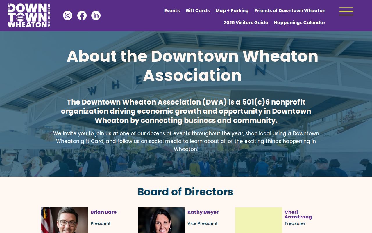
The image helps distinguish a public civic contact from a residential association. A downtown block may mix shops, offices, public land, upper-floor units, alleys, and parking parcels, so parcel class and source labels matter more than a simple nearby-address count.
Rebuild Past Wheaton Neighbors
For an older block, choose one date and keep every source near it. Wheaton Public Library holds Haines criss-cross directories, telephone books, the 1915–16 Bumstead directory, newspapers, census material, yearbooks, and maps. Sanborn coverage can add building numbers and footprints. City address-change notices help connect a retired number to a current PIN.
Do not join a 1915 name directly to a current parcel just because the street matches. Test the old number, block system, map, legal description, and any parcel split. Record directory edition and page, map year, and the relationship exactly as printed. The 1915 directory’s “r” marker indicates a residence listing in context, but it is not an owner label. That distinction is a useful local example of why neighbors, owners, and listed residents remain separate categories.
Wheaton Neighbor Source Choices
Official records and commercial neighbor tools answer different kinds of questions. The official route takes more care but shows the office, date, field, and legal relationship behind each result. Commercial tools often blend old and current data without showing why a name attaches to an address. Use the smallest source that answers the lawful question.
| Source type | Strength | Main limit |
|---|---|---|
| County GIS and assessor | Parcel geometry and labeled tax fields | Does not prove occupancy |
| Recorder and plats | Recorded land interests and lot formation | Does not list every household member |
| Library collections | Dated historical listings and maps | Coverage and spelling vary |
| Commercial category | Fast broad leads | Stale blends and unclear sourcing |
Protect Wheaton Neighbors’ Privacy
A neighbor lookup should stop at the facts needed for block, property, civic, or historical research. Do not combine assessor mailing data, voter registration, court addresses, business agents, and old directory lines into one unqualified home address. Never store identity keys entered into an official voter form. Sealed court records, restricted vital records, and protected addresses stay outside the search.
The Illinois Address Confidentiality Program provides eligible survivors a substitute address for new public records where the law applies. Existing records may remain, and property records are not guaranteed confidential. Do not use either a real or substitute address to triangulate where a protected person lives.
When the portal does not answer the block question, use a narrow fallback. Call GIS support for a layer or selection issue. Ask the Assessor about a parcel field, the Recorder about a plat or older instrument, and the City Clerk about a specific map, notice, or retained municipal file. Wheaton Public Library and the DuPage Historical Museum are the better routes for a dated historical block. A missing online result means only that the record was not visible in that system and search.
Publish the method and the public contact route whenever names add no value. For example, a parcel map can show that a park or common area separates two homes without repeating tax-listed parties. A City commission page can connect residents with a public meeting without copying private member details. This data-minimization approach still answers how the block works, and it lowers the chance that stale or mismatched information harms Wheaton neighbors.
Lawful use. Check Wheaton neighbors for civic context, history, reconnecting, or personal safety awareness. Never watch, intimidate, harass, or harm another person.