
Trace a Wheaton Street Address
A reliable Wheaton street directory search begins with the address exactly as supplied. Keep the house number, unit, direction, suffix, city, and ZIP. The DuPage Assessor ties that text to a parcel identification number, or PIN. The PIN is the best bridge to maps and recorded instruments. It identifies land, not a person. An owner or billing name in the tax system does not prove present occupancy.
- Run the address in the DuPage Property Lookup. Save the situs, municipality, PIN, and tax year.
- Open the profile. Compare situs and mailing fields, then note the legal description and split or combine flags.
- Use the DuPage Parcel Viewer to check shape, road, subdivision, and adjacent lots.
- Search the DuPage Recorder index by PIN, street, document number, or a documented party name.
- For a dated resident listing, consult Wheaton Public Library directories and telephone books. State the edition and year.
This flow separates title, tax, map, and directory evidence. Historical editions are covered in depth with the Wheaton city directory collections.
Keep an evidence ledger as the search moves forward. Record the source, date, exact address form, PIN or document number, and the relationship stated. The Assessor may name an owner or billing party, the Recorder may name a grantor or grantee, and a directory may list a person at an address. Those labels cannot be swapped. A dated ledger also prevents a current tax profile from being joined carelessly to an old map.
Search Wheaton Property Fields
The assessor offers two routes for searching by street. Its address form accepts house number, street, city, and ZIP. The combined form adds owner, billing name, township, and city controls, but instructs users to choose one parameter family at a time. Note sort and page-size settings when comparing results.
| Portal field | Input | Street use |
|---|---|---|
| Address No. | House number | Targets one site |
| Street | Street text | Builds a by-street set |
| City / Zip | Place and postal text | Tests distinct labels |
| Sort | PIN, owner, address, jurisdiction | Keeps order reproducible |
| Results | 10, 15, 20, 25, or 50 | Records display size |
The official address screen shows the Wheaton street directory controls.
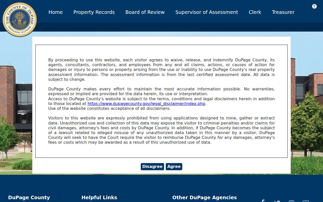
City, ZIP, sort order, and result count are separate, which explains why two searches may show different sets.
When a result fails, retry only within documented controls. Test direction and suffix in their own fields, then use the combined search with the address family alone. For a multi-unit site, retain the unit, lot, or building label. A missing match may mean the form was normalized differently, not that the parcel does not exist.
Read Wheaton Parcel Results
A parcel profile may show a PIN, property location, mailing address, owner field, assessed value, legal description, transfers, and tax districts. Those are administrative facts. The owner field is title context, while mailing may show where a bill is sent. Neither is a full resident list. A transfer row is only a lead to its recorded instrument.
The captured DuPage sample profile is outside Wheaton and serves only as a field-format example.
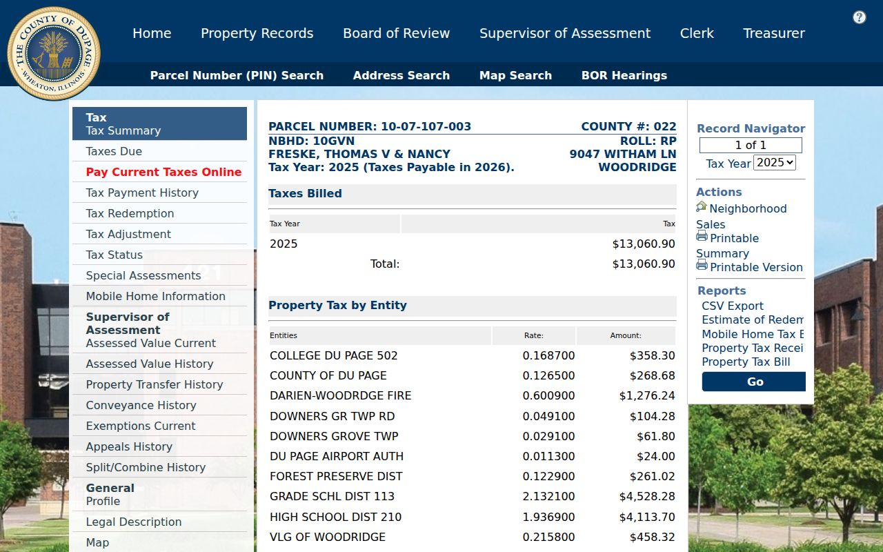
The tabs show why a street record needs labels and dates. Location, mailing, title, and tax year answer different questions.
- Parcel
- A mapped unit of land identified by a PIN.
- Situs address
- The property location, distinct from an owner's mailing address.
- Plat
- A recorded map dividing land into lots, blocks, roads, or easements.
- Criss-cross directory
- A directory arranged by address, allowing a search from place to listed name.
Map Wheaton Streets by Parcel
DuPage mapping adds shape to a text list. County GIS help describes PIN, address, and subdivision searches, parcel selection, buffers, road layers, measurement, and aerial tools. A buffer draws a set distance around a point or shape. It defines a research area, not a social relationship or occupancy.
The advanced property map exposes point, polygon, line, and buffer controls.
Save the layer, selection method, buffer distance, and capture date. A parcel outline proves geometry only when joined to its PIN record.
Wheaton Records Indexed by Address
No source acts as a full street directory. The useful result comes from matching an official source to a narrow question and keeping its limit visible.
| Address source | Custodian | What it can show | Access route |
|---|---|---|---|
| Tax parcel | DuPage Assessor | PIN, situs, owner or billing field | Online or office help |
| Parcel map | DuPage GIS | Shape, road, subdivision, nearby lots | Viewer and help PDF |
| Recorded document | DuPage Recorder | Parties, legal description, instrument trail | Online from 1961; office terminals |
| Address notice | City of Wheaton | New and retired numbers, PIN, date | Published notices or FOIA |
| Historic listing | Wheaton Public Library | Dated name, phone, work, address | Local History and Genealogy Center |
For older deeds, call 630-407-5401 or visit the Recorder at 421 N County Farm Road. Its online index begins March 16, 1961. Earlier grantor and grantee research is in person. City building files may require an Illinois Freedom of Information Act request.
Wheaton is the DuPage County seat, so county record offices are in the city being researched. They remain county offices, not City of Wheaton custodians. Assessor and Recorder staff handle parcel and instrument questions. City staff handle municipal addresses and building files. Library staff handle city directory and microfilm access.
The City record route adds facts that county property systems may not contain. Wheaton's Directory of Records identifies building and code, engineering, map, permit, and clerk categories. The City's home-research sequence points researchers toward building files and permits from about 1955, historic tax material, maps, aerial images, directories, census records, and the library's Home History Research File. Architectural plans may require both a City records request and owner permission. Keep an applicant, contractor, owner, and listed resident as separate roles when a permit file names more than one person.
Maps also run on a different clock. The City guide identifies GIS archival imagery from 1956 onward, while the Recorder's online document index starts on March 16, 1961. A 1956 image may show that a structure existed before the first instrument visible online, but an aerial view is not a title record. For each gap, write down the last date searched, the record type, the likely custodian, and whether the next step is an office terminal, library appointment, City FOIA request, or copy order.
Follow Wheaton Streets Into Deeds
The Recorder accepts names, trusts, subdivision or business names, street, PIN, document number, type, and date limits. A grantor gives an interest; a grantee receives one. Those labels matter because a mortgage, release, easement, plat, lien, quitclaim deed, and warranty deed describe different events. Search by PIN when spelling or a street number has changed, then check the legal description on the instrument.
The DuPage Recorder search shows the street, PIN, party, type, and date lanes.
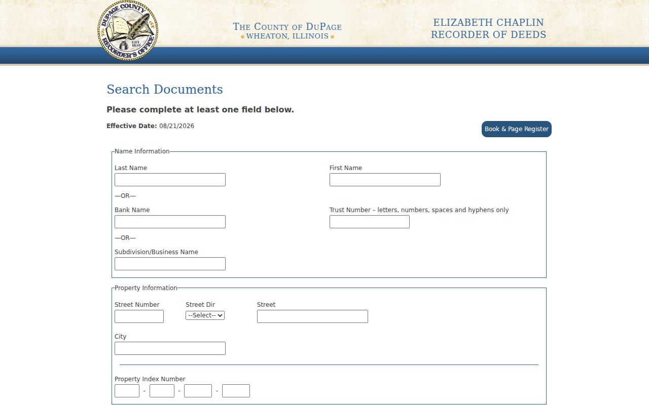
Combining a parcel with a date or document type reduces false matches without turning the index into a resident roster.
A street-name result should be reconciled with the parcel before it enters the record trail. Compare the instrument's legal description, subdivision, document date, and PIN with the assessor profile. If the numbers disagree, check for a parcel split, combination, retired address, or old abbreviation. For pre-1961 work, begin with the current legal description and most recent instrument, copy the prior party and predecessor reference, then repeat through the grantor and grantee books at the office. That backward chain is stronger than a broad surname search because common names, trusts, and spelling variants can produce unrelated Wheaton hits.
Wheaton Address Changes Matter
Recent City notices prove an address can change while the parcel stays the same. In 2026, Kandahar Court gained 1871 and 1873 while 1861 was retired for PIN 0529109036. Town Square and Cromwell notices added numbers. A 2025 Liberty Drive notice changed Liberty, Hale, and Wheaton addresses, while older notices document Cross Street, Lodalia Court, and Illinois Street.
This timely issue is not evidence of one citywide renumbering plan. Keep an alias record with old number, new number, PIN, and notice date. Test both versions in deeds, maps, and old sources. The City address-change archive is the fallback when a current search misses a known site.
Note: A changed number does not prove that an owner or listed household moved; the notice and matching PIN control that conclusion.
Decode Old Wheaton Street Numbers
The 1915 directory records a period grid in rare detail. East-west streets were numbered from Main Street. North-south streets began from Front and Michigan Streets and their extensions. One number was assigned per 25 feet and 100 numbers per block. Odd numbers sat on north and east sides, with even numbers on south and west sides.
Use the rule as a hypothesis, not a modern promise. Test a printed number against Sanborn maps, City notices, the current PIN, and the deed description. It can explain why a family seems to vanish when only the address changed. The library's Haines criss-cross runs, West Suburban 1988 through 2021 and Near West Suburban 2004 through 2021, can bridge part of that trail.
WPL also holds Wheaton telephone books from 1951 through 2016 and suburban telephone microfilm from 1920 through 1971. Many volumes cover nearby places too. Check an edition's boundary before assuming every street lies in Wheaton. An omission can result from an unlisted phone, publication gap, OCR miss, or changed coverage.
Refine a Wheaton Street Search
If the simple form misses, the combined assessor screen offers parcel ID, owner, billing name, address number, direction, street, city, township, and ZIP. Enter one parameter family, then widen with care. A miss may reflect punctuation, suffix, retired number, parcel split, or a postal-city mismatch.
The combined property search displays these distinct routes.
Keep the query and result date. The portal's tax-year label is not a deed date or proof of a current household.
Limits of Wheaton Street Records
A Wheaton street directory cannot provide a complete, verified roll of everyone at an address. Assessor and deed records identify property relationships. A historical directory supplies a dated listing. The election address lookup serves precinct, district, polling-place, and sample-ballot questions, and Illinois law restricts copying, transmission, solicitation, and other uses of voter data. A failed portal result means only that nothing appeared for that query and date.
Use lawful access channels and stop when the question is answered. Confirm parcel facts with the assessor, instruments with the Recorder, address facts with the City Clerk, and old entries with the scanned edition. Do not expose a block's names merely because screens can be searched.
Lawful use. Wheaton address records may support legitimate personal research. Never use them to stalk, harass, intimidate, or harm another person.